


Earthquake
It is a transient violent movement of the Earth's surface that follows a release of energy in the Earth's crust.
2. Magnitude
It is a measure of the amount of energy released during an earthquake and expressed by Richter scale.
Effect of earthquake according to Richter scale.
Richter Magnitude Earthquake effects
Less than 3.5 Generally not felt, but recorded.
3.5-5.4 Often felt, but rarely causes damage.
Under 6.0 At most, slight damage to well-designed buildings. Can cause major damage to poorly constructed buildings over small regions.
6.1-6.9 Can be destructive in areas up to about 100 across where people live.
7.0-7.9 Major earthquake. Can cause serious damage over larger areas.
8 or greater Great Earthquake. Can cause serious damage in areas several hundred across.
3. Intensity
Intensity is a qualitative measure of the actual shaking at a location during an Earthquake, and is assigned in Roman Capital Numerical. It refers to the effects of earthquakes. Modified Mercalli scale is the standard measurement.
The intensity scale is based on the features of shaking, perception by people and animals, performance of buildings, and changes to natural surroundings.
Effects of earthquake based on its intensity
Intensity. Earthquake effects
I People do not feel any Earth movement
II A few people might notice movement if they are at rest and/or on the upper floors of tall buildings
III Many people indoors feel the movement. Hanging objects swing back and forth. People outdoors might not realize that an earthquake is occurring
IV Again, most people indoors feel the movement. The earthquake feels like a heavy truck hitting the walls. A few people outdoors may feel the movement as well.
V Almost everyone feels the movement. Sleeping people are awakened. Doors swing open or close. Dishes are broken. Trees might shake.
VI Everyone feels the movement. People have trouble walking. Objects fall from shelves. Damage is slight in poorly built buildings. No structural damage.
VII People have difficulty standing. Drivers feel their cars shaking. Some furniture breaks. Loose bricks fall from buildings.
VIII Drivers have trouble steering. Tall structures such as chimneys might twist and fall. Well-built buildings suffer slight damage. Poorly built structures suffer severe damage.
IX Well-built buildings suffer considerable damage. Some underground pipes are broken. The ground cracks. Reservoirs suffer serious damage.
X Most buildings and their foundations are destroyed. Some bridges are destroyed. Dams are seriously damaged. Large landslides occur. The ground cracks in large areas. Railroad tracks are bent slightly.
XI Most buildings collapse. Some bridges are destroyed. Large cracks appear in the ground. Underground pipelines are destroyed. Railroad tracks are badly bent.
XII Almost everything is destroyed. Objects are thrown into the air. The ground moves in waves or ripples. Large amounts of rock may move.
4. Focus or hypocenter
It is the point within the earth where an earthquake rupture starts
5. Epicenter
It is the point on the earth's surface vertically above the hypocenter, point in the crust.
6. Body waves
They move through the interior of the earth, as opposed to surface waves that ravel near the earth's surface.
6.1 P wave
A P wave, or compressional wave, the ground back and forth in the same direction and the opposite direction in the direction the wave is moving.
6.2 S wave
An S wave, or shear wave, shakes the ground back and forth perpendicular to the direction the wave is moving. S wave can travel only through solids.
7. Shallow Focus Earthquake
Earthquakes of focus less than 70 km deep from ground surface are called shallow focus earthquakes.
8. Teleseism
A teleseism is an earthquake recorded by a seismograph at a distance. By international convention the distance is over 1000 Kilometers from the epicenter.
9. Microseism
These are more or less continuous disturbances in the ground recorded by seismographs.
10. Micro earthquake
A very small earthquake having a magnitude measurable less than three on scale is called a Micro-earthquake.
11. Accelerogram
The ground acceleration record produced by Accelerograph is called Accelerogram.
12. Accelerograph
This is an earthquake-recording device designed to measure the ground motion in terms of acceleration in the epicentral region of strong shaking.
13. Focal distance
The straight-line distance between the places of recording/observation to the hypocenter is called the focal distance.
14. Intermediate Focus Earthquake
When the focus of an Earthquake is between 70 to 300 km deep it is termed as Intermediate Focus Earthquake.
15. Epicentral Distance
Distance between epicenter and recording station(in km) is termed as Epicentral Distance.
16. Foreshocks
Smaller earthquakes preceding the main earthquake results in the generation of Foreshocks.
17. Aftershocks
Smaller earthquakes following the main earthquake results in the development of aftershocks.
18. Benioff zone
A region of earthquake activity inclined at an angle underneath a destructive boundary.
19. Destructive boundary
A part of the earth's crust where tectonic plates move towards one another, resulting in the seduction of one below the other.
20. Fault
A fracture in the rocks along which strain is occasionally released as an earthquake.
21. Active fault
Faults considered to be active if they have moved one or more time in the 10000 years.
22. Liquefaction
The process by which sediments and soil collapse, behaving like a thick liquid when shaken by earthquake waves.
23. Magnitude/frequency relationship
The observed relationship (with most hazards) that bigger scale events occur less frequently while smaller scale events are relatively common.
24. Richter scale
A measure of earthquake magnitude allowing an estimate of energy levels involved.
25. Rossi-Forrel scale
An observational scale for measuring earthquake intensity. This was improved and expanded by Mercalli to produce the "Modified Mercalli Scale".
26. Seismometer
An instrument for detecting and recording earthquake waves.
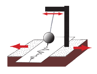
27. Seismograph
A printout from a seismometer. Studies of seismograph traces can be used to pinpoint both the epicenter of an earthquake and the nature of the fault movement.
28. Tsunami
An earthquake generated sea wave. Can travel thousands of miles and reach many metres in height when approaching shallow water.
Comments
Post a Comment